Monte Pasubio on the border between the provinces of Vicenza and Trento
Strada Della Prima Armata, 36030 Valli del Pasubio VI
Parking spaces are available for cars and motorbikes.
My visiting period: 05/06/2021 and 07/11/2021
Refuge Gen. Achille Papa 1929m opened from June to November
Recommended visiting period: April – November
Height difference: 900m
Length: about 17 km
Maximum altitude of the tunnels: 2020m
Signposting: CAI paths 366, 370
Recommended for: lovers of Great War (WWI) history, nature and animals, people interested in trekking and walking, photographers, and people with a minimum of physical preparation. The excursion is technically easy, as it is on an easily identifiable and adequately marked path. Still, you’ll constantly be climbing on your way up. The use of torches in the tunnels and adequate mountain equipment is required…
“Strada Delle 52 Gallerie” (Road of the 52 Tunnels) is a path about 6.3 km long, marked by CAI trail sign 366, which starts from the car park at Bocchetta Campiglia and ends at Porte del Pasubio (Pasubio Doors). The “Gen. Achille Papa Refuge” is reached after walking along the southern side of the mountain, enjoying panoramic views and glimpses of the surrounding valleys and mountains, after crossing the fifty-two tunnels that compose this route. The route is of remarkable historical and environmental interest, as it is a military mule track built during the Great War (WWI) on the Pasubio massif. It is suggested to bring a torch and a pair of hiking boots, as there are turns inside some of the tunnels that are not illuminated by the openings, and the ground inside the tunnel can be wet and slippery. The route is of extraordinary historical and environmental interest, as it is a military mule track built during the Great War on the Pasubio massif.


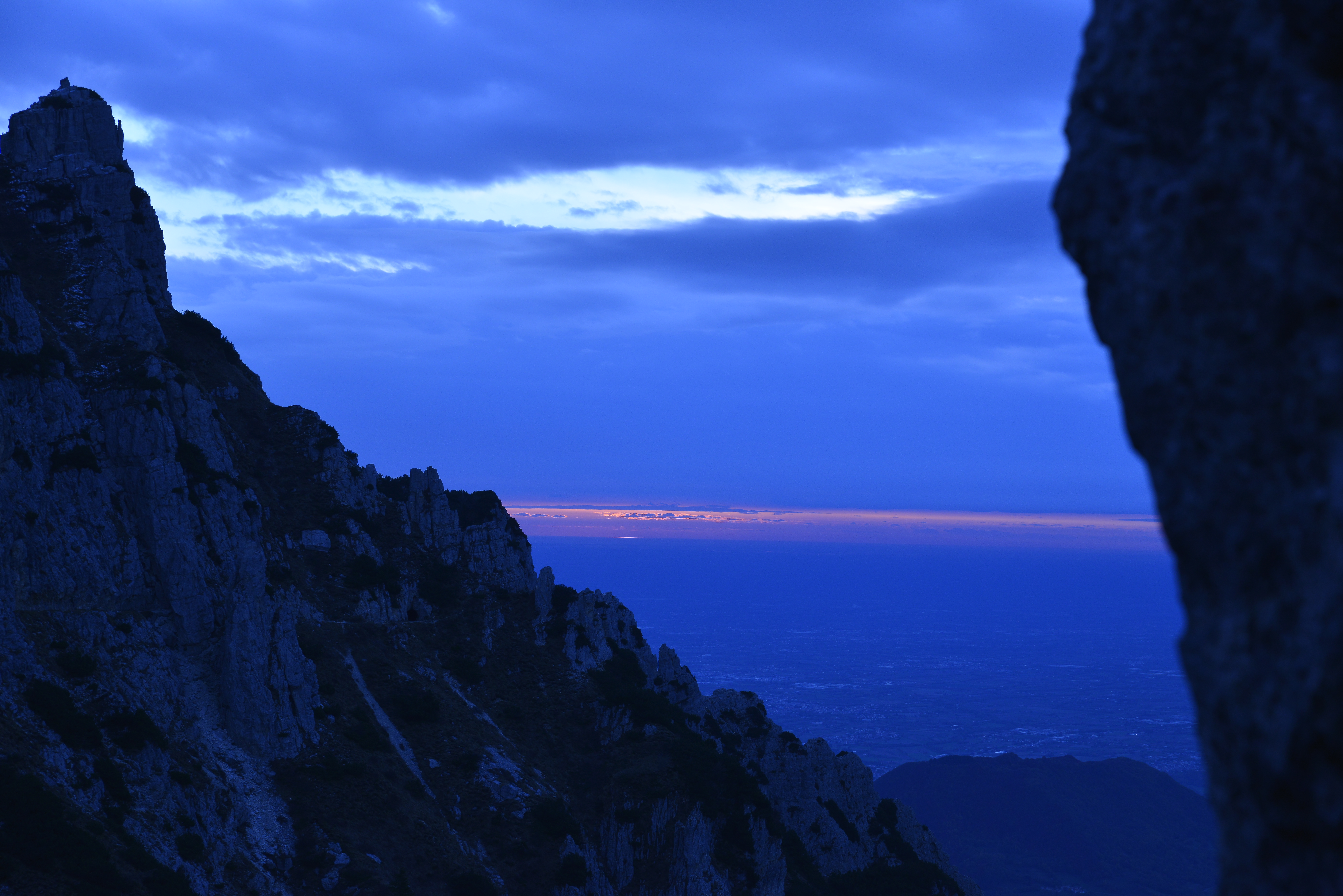
Pasubio mountain is a limestone massif located on the border between the provinces of Vicenza and Trento. It is a junction between the Piccole Dolomiti (Little Dolomites) and the “Regione Dei Tre Altopiani” (Three Plateaus region). Pasubio mountain has steep, rocky faces of a typically dolomitic character on almost every side, with characteristic peaks, gorges, and canyons. The wild and impervious side valleys offer multiple access routes to the mountain’s summit. The summit consists of a plateau of about 2000 m above sea level, where ridges and vast grassy hollows alternate, once used as pastures. The area surrounding Cima Palon (Paolon Summit) (2232 m.high) and the two “Denti” (Tooth) (“Dente Italiano” (Italian Tooth) -2220 m., “Dente Austriaco” (Austrian Tooth) -2203 m.) was declared a “Sacred Zone” by the Royal Decree n. 1386 in 1922. The area between these Denti was the scene of bloody battles; in fact, the first line crossed the main ridge perpendicularly at the “Selletta Dei Denti” (Tooth’s star). The top of the mountain still shows the scars of this terrible fight that lasted from June 1916 to November 1918, you can still see the craters of the grenades and bombs, and you can recognize trenches, walkways, tunnels, and shelters from a century ago, some of which have recently been restored.

The network of paths, which currently crosses the Pasubio in all directions, follows the military paths used during the war.
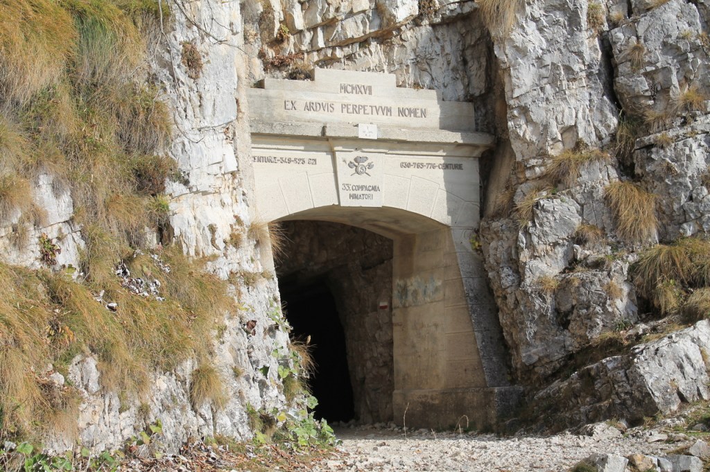
The “Strada Delle 52 Gallerie” (Road of the 52 Tunnels) was built during the Great War (WWI) to allow the Italian troops to communicate and resupply their defensive line, sheltered from the sight and the offensive of the enemy in any season and down any weather. The first line, located on the summit of Pasubio, had the arduous task of preventing the advance of the Austrian army attacking from the valley, and could also be supplied by the Scarubbi roadway, which could also be traveled by lorries, but only in the summer season and at night, as it was exposed to the sight of the Austrian artillery observers stationed on the mountains.
The Road is considered a masterpiece of military engineering and was conceived by Captain L. Motti and designed by Lt. Engineer G. Zappa, who did not manage to see the work completed and was replaced by Captain Corrado Picone. The work began in March 1917, in the middle of one of the harshest winters of the century, and finished eight months later in December of the same year. This work was carried out by the 33rd Miners Company of the 5th Engineer Regiment of the Italian Army, with the help of six teams of local workers: the n. 349, the n. 523, the n.621, the n.630, the n. 765 and the n. 776.
The strength of many men was employed in any kind of activity related to landmines (starting at about twenty and arriving at about six hundred). These workers had to use pneumatic hammers and various types of explosives depending on the availability of the warehouses. At the beginning of December 1917, the 33rd Miners’ Company, before being transferred to Val Chiampo, knocked down the drystone wall that covered the entrance to the first tunnel, making it visible as it is today. About 400 cubic meters of fence were built, using stone extracted from the nearby Mount Forni Alti. The Autonomous Platoon of the 25th Miners’ Company completed the work and received awards and commendations with the help of the remaining workers’ brigade.
This is the result of “tenacious will, exemplary work, sacrifice, even self-sacrifice, and a moving spirit of emulation among the teams of mine engineers involved in the construction”.
Capitano C. Picone

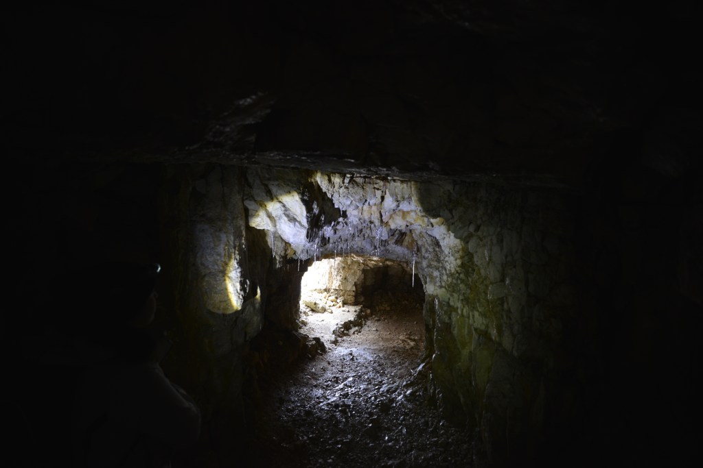
La strada delle 52 gallerie, contrassegnata dalla segnaletica 366 del C.A.I., è percorribile a piedi nella stagione estiva, ma a è vietata ai ciclisti seguito di alcuni incidenti mortali verificatisi sul suo percorso. L’inizio è situato presso il parcheggio a pagamento di Bocchetta Campiglia ed il tempo di percorrenza fino al Rifugio Papa è di circa 2.45 ore. All’entrata di ciascuna galleria, inoltre, troviamo il nome e il numero progressivo assegnato. Si ritiene indispensabile la torcia elettrica o la lampada frontale per percorrere le parti al buio.
Si consiglia vivamente di prestare particolare attenzione alla neve, che potrebbe chiudere gli imbocchi delle galleries.
“Strada Delle 52 Gallerie” (Road of the 52 Tunnels), marked by CAI trail sign 366, is practicable on foot in the summer but is forbidden to cycle in because some fatal accidents occurred along its route. It starts at the paying car park at Bocchetta Campiglia and takes about 2.45 hours to reach Rifugio Papa. At the entrance to each gallery, you will find the name and the progressive number assigned. It is essential to use a torch or headlamp to walk through the galleries dark parts.
It is strongly recommended to pay particular attention to the snow, which could close the tunnel openings.
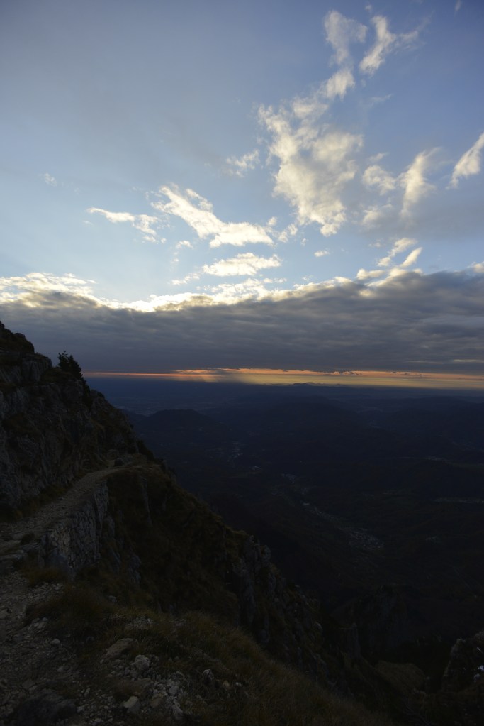
The total length of the road is approximately 6.3 km, of which the development of the 52 tunnels occupies 2.3 km, and the remaining 4 km are excavated halfway up the mountainside in the rock. The minimum width of the road is 2.50 m. The tunnels were electrically illuminated, even though natural light entered through the open windows in the walls. The average gradient of the road is 12%, with a maximum gradient of 22% of some parts. Four tunnels have a spiral development, of which the 19th is the longest with its 320 meters. Shortly after exiting the 48th tunnel, the maximum altitude of the mule track is reached (around 2,000 m above sea level). At the exit of the 52nd tunnel, which is the last one, we reach the Achille Papa Refuge. From there it is suggested to visit the Sacred Zone, the Roman Arch and the Italian War Cemetery “Di qui non si passa” (no way through here). For the return journey, it is advisable to take the Scarubbi carriageway, with appropriate shortcuts, which leads to Bocchetta Campiglia. Still, it is possible to return to the car park along the same route as the uphill using a small shortcut from the Porte del Pasubio to the Fontana d’Oro (Golden Fountain) Pass .


Tip: use the appropriate equipment, always consult the weather forecast and take a look at the webcam of ref. A. Papa alle Porte del Pasubio
DiscordArtE
Have you been there?
Would you like to stay updated? Follow us!

Follow your curiosity!
